Wake up to glassy water, seabirds, and neighbors paddling by on their way to work. If you’ve wondered what it really feels like to live on the water without leaving the Peninsula, Foster City delivers a calm, everyday version of the waterfront lifestyle. In this guide, you’ll learn how the lagoon system shapes daily routines, which parks and trails you’ll use most, the rules that keep the water peaceful, and how homes connect to the canals. Let’s dive in.
Foster City at a glance
Foster City is a purpose-built lagoon community on the Bay, with water woven through compact neighborhoods. The city’s 2024 population estimate is about 32,657, and land area is roughly 3.79 square miles, according to U.S. Census QuickFacts. You’ll find a strong park network too: the city reports about 218 acres of parkland across 24 parks, including large gathering spots like Leo J. Ryan Memorial Park and Sea Cloud Park, which shape much of daily life and weekend routines (city summary on parks and open space).
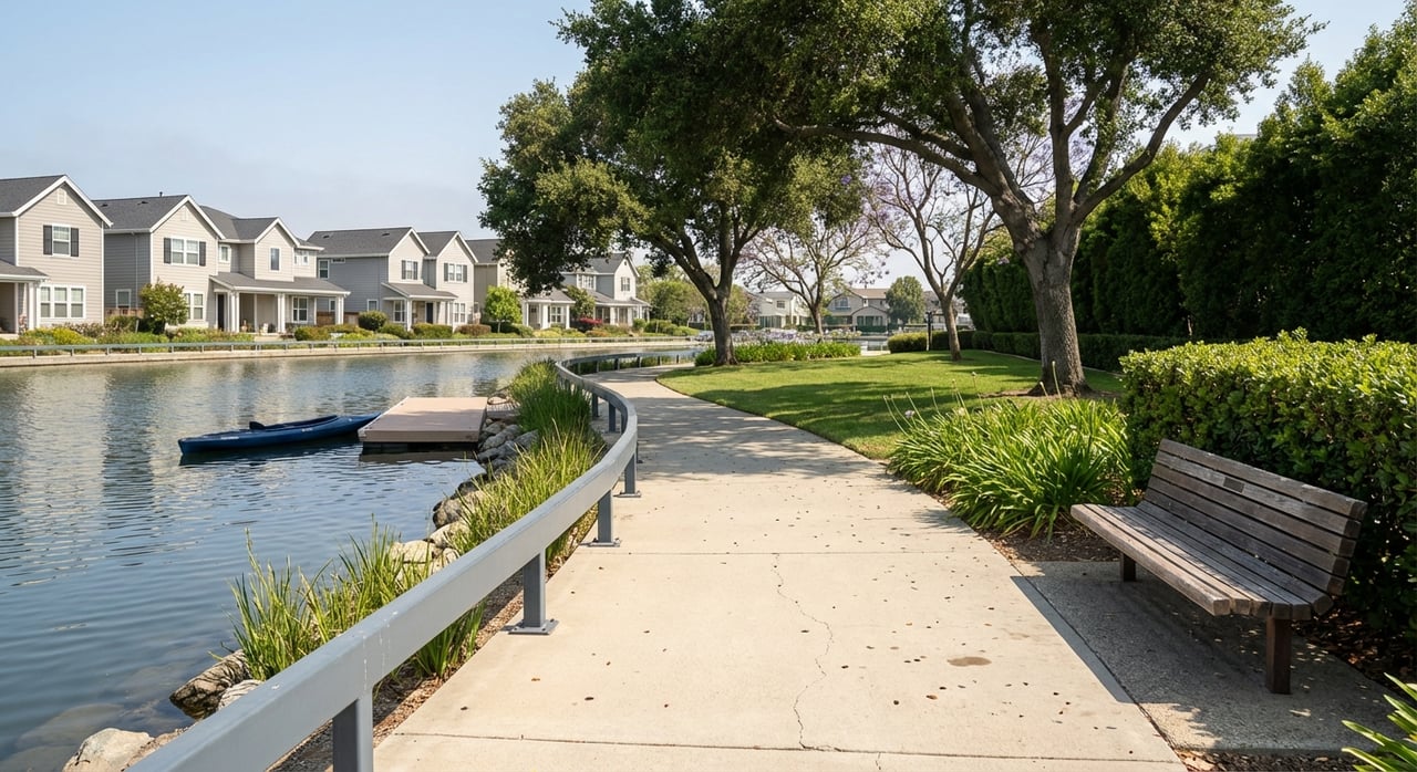
You’ll live among a network of lagoons and canals that thread through the neighborhoods. Different sources measure the total mileage in different ways, so think of it as a connected system rather than a single number.
Waterfront life, every day
What you can do on the water
On any given day, you’ll see people kayaking, stand-up paddleboarding, sailing, cruising in small electric boats, and swimming in protected park beaches. Designated bayside spots host windsurfers and kiteboarders when the breeze comes up, especially near Baywinds off East 3rd Avenue. The city’s guidance outlines permitted uses and safety basics for a smooth, shared experience on the lagoon (Foster City water activities and rules).
When the wind is up, the Baywinds area at 3rd Avenue is a long-standing launch for wind and kite sports, with local groups offering tips and seasonal clinics (Baywinds/3rd Ave site info).
Where to launch and rent
You have two formal public boat ramps: Boat Park at Bounty Drive and the ramp at Leo J. Ryan Memorial Park. Leo J. Ryan functions as a recreation hub with a boathouse, tie-up areas, and lessons or rentals for SUPs, kayaks, and wind-sport gear in season (city water activities overview). Many apartment and condo communities also advertise shared dock areas or small-craft launches, which makes quick after-work paddles part of your routine.
Clubs and community energy
Paddling clubs train on the lagoon and host spectator-friendly races. The Bay Area Dragons, for example, bring dragon-boat sprint events to Leo J. Ryan Park that attract families and casual observers alike (local coverage of dragon-boat events). Summer also brings outdoor concerts and holiday gatherings to the waterfront. Specific dates and formats vary year to year, so check the city and chamber calendars when you plan.
Rules that keep it peaceful
Foster City’s lagoon is intentionally quiet. Gasoline and diesel motors are not allowed. Only sail, electric, or human-powered craft are permitted, and there is a 5 mph speed limit. The city outlines boater safety tips, life-jacket rules for youth, and registration requirements for certain craft on its official water activities page (boating rules and safety). These rules shape a calm, family-friendly rhythm on the water, especially outside of peak summer crowds.
Parks and trails you’ll use most
Leo J. Ryan Memorial Park
Leo J. Ryan is the social heart of the waterfront. It brings together a boardwalk and amphitheater with open lawns, a recreation center, and tie-up facilities that keep daily activity centered right on the water. It is also home base for many community events and seasonal programs (park overview).
Neighborhood parks and play
Across the city, smaller parks like Gull Park, Marlin Park, and Shorebird Park offer lawns, playgrounds, and sandy edges where you can wade on warm days. Sea Cloud Park anchors larger sports fields and weekend leagues that add to the community feel. With parks distributed through neighborhoods, most residents have a short walk to green space.
Levee pedway and the Bay Trail
Foster City’s shoreline path is part of the region-wide San Francisco Bay Trail. The levee-top pedway is a paved, multi-use route valued for wide bay views and direct connections to nearby cities and the San Mateo–Hayward Bridge area (Bay Trail map, local segment). Ongoing levee maintenance and upgrades sometimes trigger short-term closures, so check city notices before planning a continuous shoreline loop (example of temporary closure notice).
Homes that meet the water
Housing mix and market context
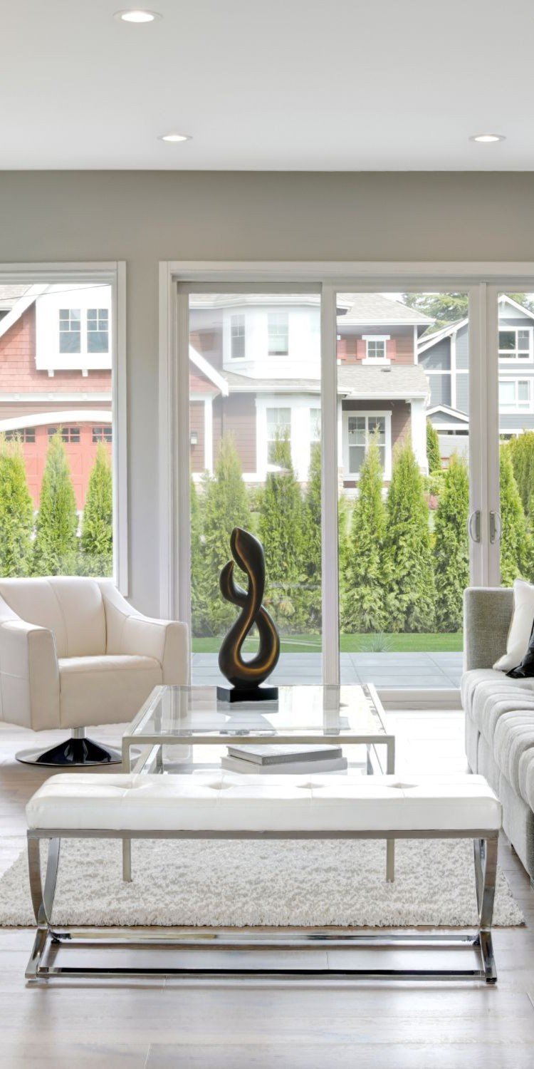
You’ll see a blend of older single-family homes, clusters of mid-century Eichler designs, attached homes, townhomes, condos, and rental communities. Foster City has roughly 13,000 households, with owner-occupied housing near half of all units and median owner values in the high seven figures, based on U.S. Census QuickFacts. This mix supports everything from upscale waterfront single-family living to condo developments that emphasize lagoon access.
Waterfront access types
Waterfront single-family lots often face canals or the central lagoon. Many are marketed with private docks, while multi-family communities commonly provide shared launches or dock areas. Public tie-ups and two city ramps round out your options. If a specific property advertises a dock, confirm whether it is deeded and permitted, and understand any moorage or HOA rules before you buy (city page on ramps and tie-ups).
What daily life looks like at home
For lagoon-front households, the water can feel like an extension of your backyard. You might store a couple of SUPs on a patio rack, slide a kayak in before breakfast, or take an evening cruise in a small electric skiff. Inland homes and condos often trade direct water access for quick walks to parks and the levee pedway, which still puts the waterfront into your daily routine.
Resilience and peace of mind
Levee improvements you’ll notice
Foster City has invested in a multi-year levee project that added steel sheet-pile sections, floodgates, and pedway upgrades to meet FEMA and regional standards. You can see the taller shoreline protection in some neighborhoods, and you may encounter routing changes while work wraps. For context on the goals and sea-level-rise planning behind the project, review the San Francisco Chronicle’s in-depth report.
Insurance and access notes
Levee certification and updated FEMA mapping have influenced local insurance conversations in recent years. If you are evaluating a specific property, use recent official sources and the Chronicle’s reporting for the latest on insurance and access implications (overview of levee context).
Getting around and daily rhythm
Foster City sits next to Highway 101 and the San Mateo–Hayward Bridge, which makes car access to Peninsula job centers and the East Bay straightforward. Public transit is more limited than in denser cities, so many residents rely on cars for errands and commuting. For objective local stats like mean travel time and household profiles, explore U.S. Census QuickFacts.
Families often plan daily life around nearby schools, sports, and after-school activities. Foster City is served by the San Mateo–Foster City School District for K–8, and high school students typically attend schools in the San Mateo Union High School District. Always confirm the most current boundaries and assignments with official sources (city education overview).
Is Foster City a fit for you?
Consider these quick prompts as you plan your move:
- You want regular, low-stress time on the water without leaving the Peninsula.
- You value parks, levee-top walks, and easy access to the Bay Trail.
- Quiet, human-powered boating rules sound like a plus.
- You prefer a neighborhood feel with city-scale amenities close by.
- You’re weighing direct-dock living against shared-access condo or townhome options.
If that sounds right, the next step is to match your lifestyle goals to the right waterfront setting and confirm the details that matter, like dock rights, HOA rules, and commute patterns.
Ready to explore Foster City’s waterfront options or prep your home for market? Connect with Mona & Raven Naber for local guidance, data-driven pricing, and hands-on staging and marketing.
FAQs
Can I keep a boat at my Foster City home?
- Many waterfront lots are marketed with private docks and some communities offer shared launches. The city maintains two public ramps and tie-ups, and gasoline or diesel motors are not allowed on the lagoon. Always confirm deeded dock rights and permits for a specific property (city boating rules and access).
Will the new levee block my view or access to the water?
- Sections of the shoreline protection are taller and visible from areas like Beach Park Boulevard. The levee also includes a multi-use pedway, and occasional construction has changed access temporarily. For the latest, consult city notices and the Chronicle’s levee overview (context on the levee program).
Is the lagoon peaceful or busy day to day?
- The lagoon is intentionally quiet due to permitted uses: sail, electric, and human-powered craft at low speeds. Expect more activity in summer and during organized events like dragon-boat races, with calmer mornings and evenings most days (city water activities and rules).
Where can I launch or rent paddling gear?
- Public ramps are at Boat Park on Bounty Drive and at Leo J. Ryan Memorial Park, which also functions as a rec hub with tie-ups and seasonal rentals. Wind and kite sports typically launch near Baywinds at 3rd Avenue (launch and wind-sport info).
How does the Bay Trail connect through Foster City?
- The levee-top pedway is part of the San Francisco Bay Trail and links Foster City to neighboring shoreline segments and the San Mateo–Hayward Bridge area. Temporary closures can occur during maintenance, so check the Bay Trail map and city updates before planning longer loops (Bay Trail map, local segment).